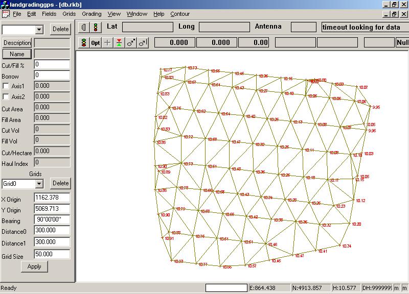
Ezigrade needs a DTM (Digital Terrain Model) to operate. This is a series of triangles that represents the natural surface.
From contour menu click on the form triangles option.
Alternatively enter your surface points manually, through Total Station or import from another package.