| < Previous page | Next page > |
Convert to readable format (stadia)
CDSViewer has an option to convert the raw data file into a human readable form so that you can view your shots in the field.Once you have the SDR33 file on your Android device run the "cdsviewer" app. On the main screen it displays similar to this.
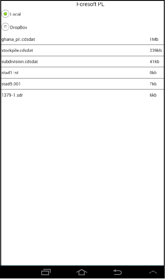
In this example we are importing a sdr33 file. Look for any files listed with a ".sdr" extension. In this case we have the one file called "1379-1.sdr". Tap on the menu entry using your pointer device or your finger. CDSViewer will convert this file into a format that can be displayed in a human readable form. Once you tap the file a "stadia" file is produced. It will have the same name with an extension of ".stadia". In this case the file will be called "1379-1.stadia".
Tap this file and the stadia will be displayed in a grid type format as seen below.
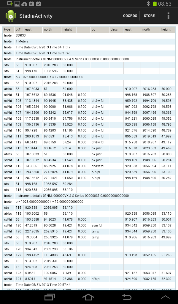
At present this is a viewer only. We will add in interactive editting in the "short term".
The left most field contains the type of the data entry. The following types are defined:
(1) OL 1.0 use this when you can't shoot the exact point. The point is set 1m (or foot) to the left.
(2) OR 1.0 The point is set 1m (or feet) to the right.
(3) FW 1.0 The point is calculated 1 meter (or feet) further along.
(4) BK 1.0 The point is calculated 1 meter (or feet) closer to the setup point.
I may also be worth reading the following. This is help for the "stadia" program for CDS running on Window's Desktop.
There are two activity options. First will calculate coordinates. Until we implement the interactive editting there is currently little use for this option as we already calculate coordinates automatically upon entry.
Second option is for "Store". This creates a cds database that is displayable as a visual check.
|