| < Previous page | Next page > |
Importing an ePlan LandXML
In this tutorial we show how you can import an existing ePlan LandXML file and we will investigate the relevant components.
We have a file DP1117750.xml This file should have been installed within the "my documents\cds2. If it is not there you can download it from our ftp site ftp.foresoft.com, the user name is anonftp and the password is foresoft1
Lets first create a blank. From The File - New menu item create a new file and give it a name of landxml
To import the LandXML file select the menu item File - Import LandXML. A dialog is shown; simply click on the "Read" button and the file is imported. Simple as that. See the screen shot below.
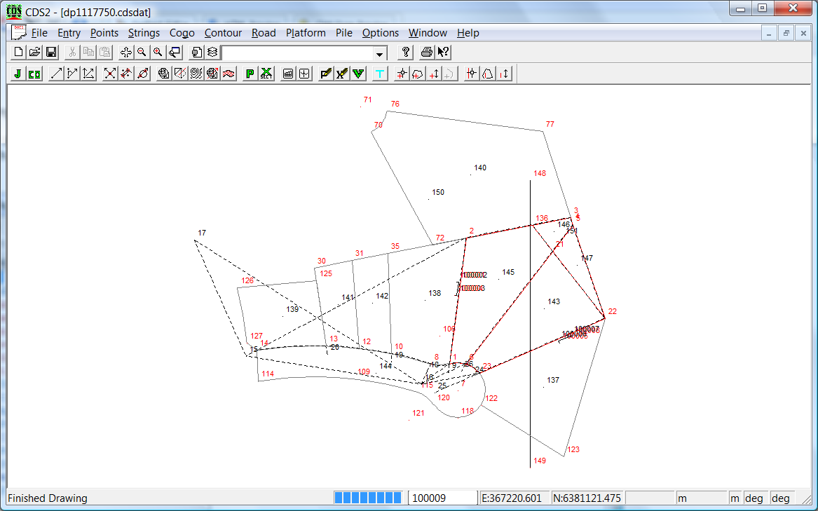
The ePlan XML data is converted to a format consistent with CDS.
Eplan Points and Monuments are imported as points. The layer the point is set to defines how the point is used. Additionally the points have attributes set that further define the point.
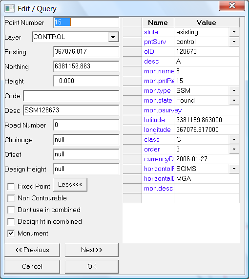
Monuments (ie fixed points) are stored as points. They are either on the "control", "existingreference" or "proposedreference" layer.reference" or the "proposed" layer. Also the "monument" is ticked. Depending on the type of data the appropriate point attributes are filled in. In the example below we are looking at a SCIM control mark. It is placed on a "control" layer and has the appropriate attributes set by the import routine.
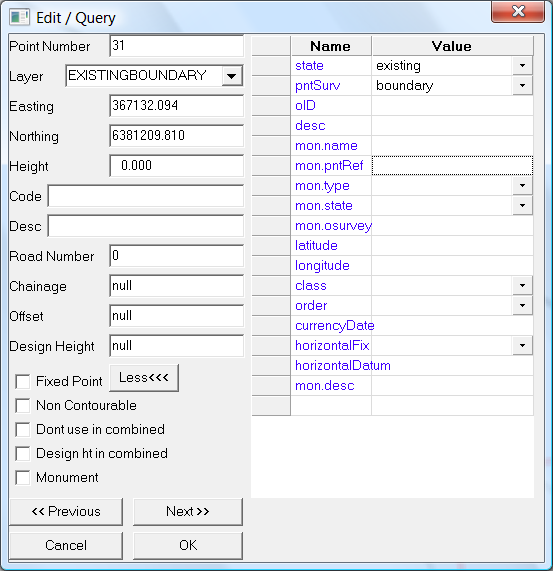
A typical point that makes up a point on an adjoining string looks like the following. It is placed on a layer "existingboundary" and has an attribute of "state" and "pntSurv" set.
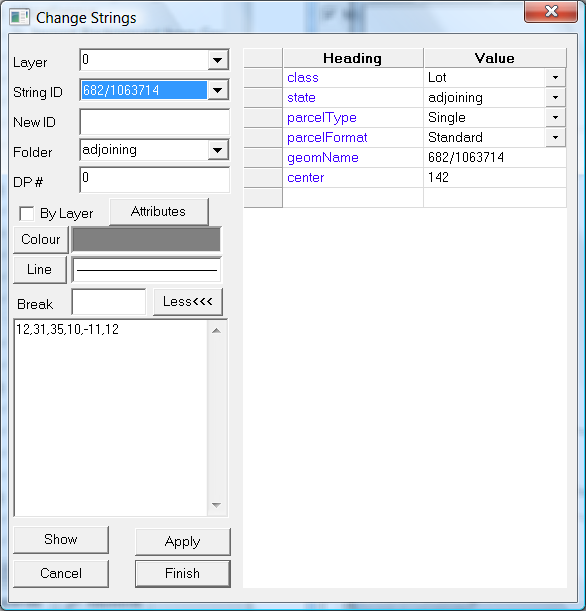
We also have a number of different types of strings imported. Again depending on the function of the string. An adjoining lot would typically look like the following. Strings are placed in the appropriate folder to specify how they are used. In the example below we have an adjoining lot to the proposed lot or lots. Again appropriate attributes are set that ePlan needs.
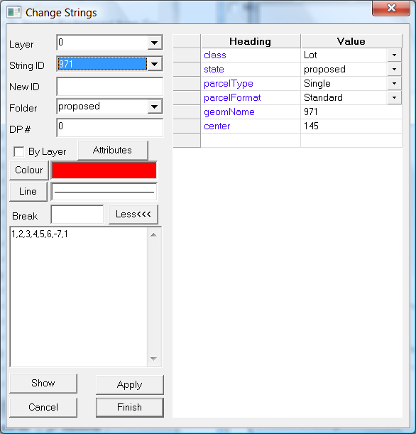
A proposed lot. ie either a new or subdivided lot is as follows. You will notice it is in a folder called "proposed" and the state attribute is also set to "proposed".
Investigating the Data within the XML:
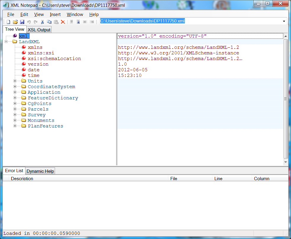
The LandXML format is in a ascii or unicode format and can be viewed in an appropriate viewer. I personally use either notepad or XML notepad.
We suggest that you install on your computer an XML editor. We use XML Notepad, as it is a free program form Microsoft. The xml file includes a link to a check schema; and Notepad can flag format errors in the file. XML Notepad will flag gross errors in the data as well as giving us an idea of the data that we have just imported.
Please note: If you modify an XML and try and send it to LPI NSW; then there parser will fail on it. (Vic is OK). The landxml specification allows a couple of hidden characters at the start of the XML which allows a viewer/parser etc to decide whether we have ascii or unicode etc. There parser will fail on the first line. For NSW ePlan modifications we use notepad++. There are some commercial editors that allows you to include or not include the hidden characters (BOM chars) so that is another option.
The major sections of the data are displayed in the left Tree View. I will briefly summarize below what they are:
We suggest you view a number of xml files to gain an understanding of what we are looking at. Our job is to reduce the complexity and streamline the process. However there are times when it may be necessary to edit the data directly.
|