| < Previous page | Next page > |
Reviewing an EPlan in CDS
This continues on from the previous chapter and shows how a NSW ePlan is displayed and represented within CDS. ePlans from other states are very similar so there will be little or any difference.
Importing the ePlan LandXML files converts all the data into relevant points and strings in the CDS database. We have added in extra attributes for both points and strings that store away data values that contain data such as whether the point is a monument and extra relevant data.
At present all relevant attributes are stored for each seperate points. Strings can contain attributes only relevant for that particular string.
CDS Points
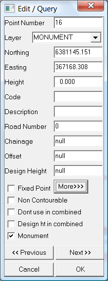
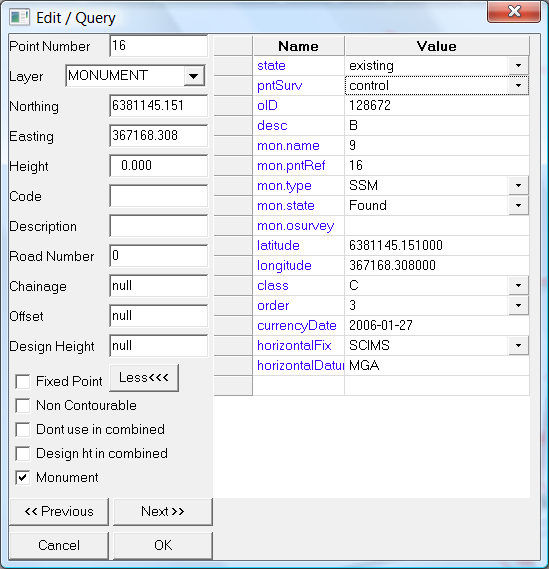
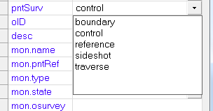
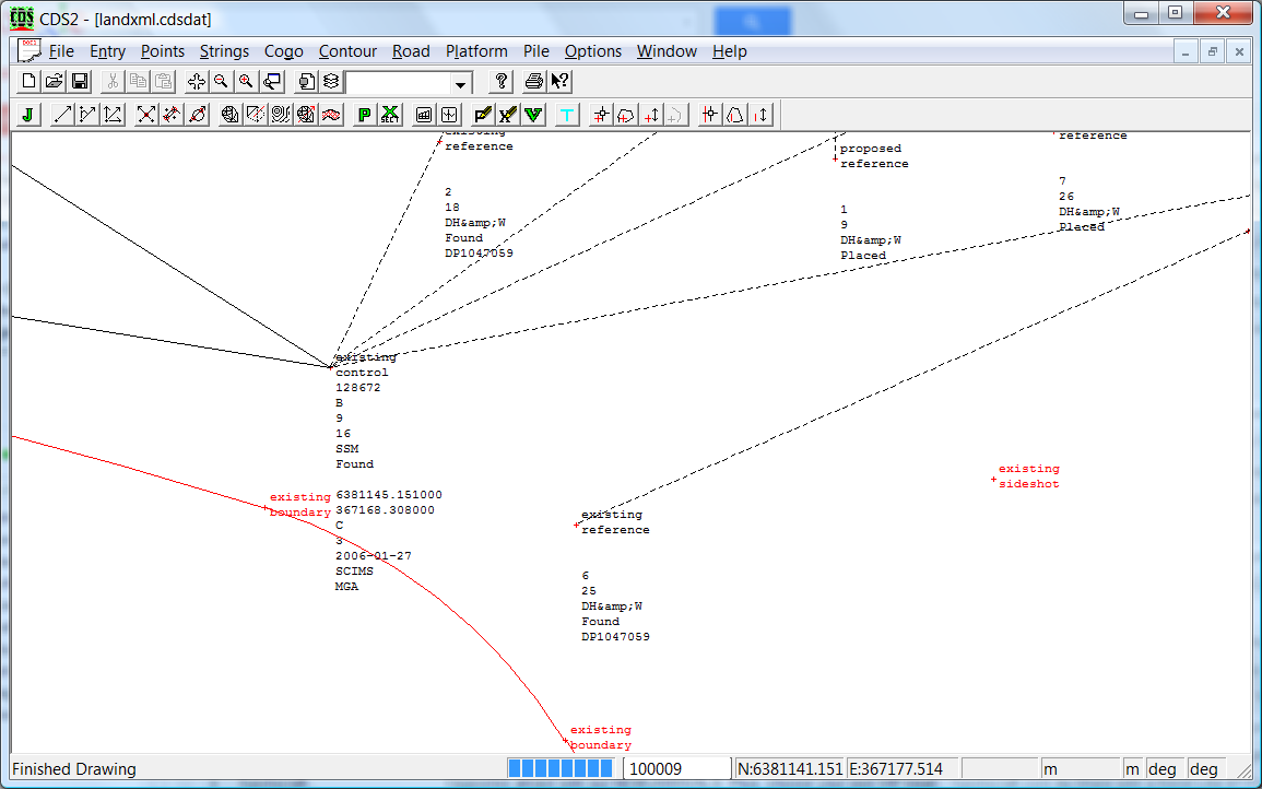
We can check the values that are stored for each relevant point. Right click on point 16 and you will see the point attributes as below. Point 16 is one of the permanent marks that are part of the job. If there are no attributes displayed as in the screen below left, then press the "More" button and you will get an expanded view as per bottom right. You can move the dividing line left and right to better display the data. These extra attributes have been added in automatically when we imported the ePlan LandXML. Some of the attributes have a number of predefined values. These attributes for example pntSurvey have a drop down list included. If you hit the drop down list you can choose an appropriate value that is allowed. For this element the allowable values are boundary, control, reference, sideshot and traverse.
We can also display graphically the attributes that are stored with each point. From the "modes" icon button (left of the layers button) make sure we have the "Modes" option selected and the "Points" and "Attributes" values selected.
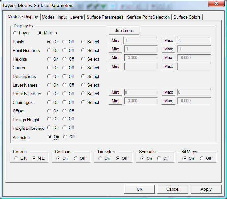
If you now view the screen you will see the various point attributes are displayed.
You can also display by layers and display "attributes" for the appropriate layer.
CDS Strings
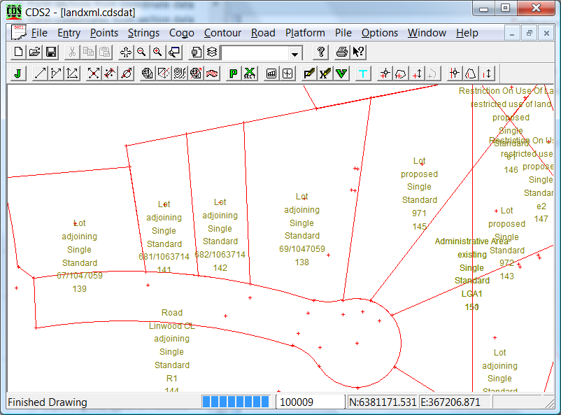
The remaining ePlan entities are represented as strings. These strings are imported into three seperate folders.
Parcels - these strings represent lots, easements, roads etc
Planfeature - these strings represent entities such as wall, sheds, houses etc.
Reducedobservation - these strings represent the raw data shots.
To view the appropriate strings then go to the Strings - Strings to Display/Print and tick/untick the appropriate folders.
Each of these strings also contains a number of attributes relevant to it's use. To display the Attributes go to the Strings - Attributes menu item and tick the attributes radio button. We have turned off everything except the "Parcel" folder and turned on attributes. We can see the following as below. Repeat a similar procedure for "Planfeatures" as well as "Reducedobservations".
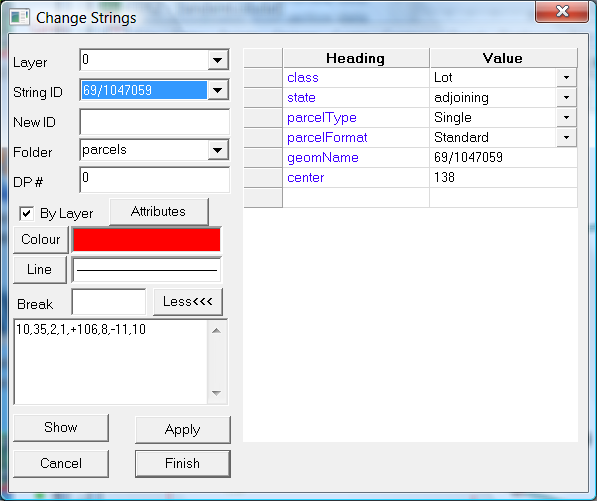
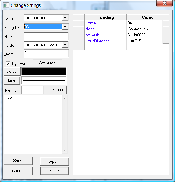
If you wish to interrogate a single string then right click on the string and view the attributes. As per points if a particular attribute has a fixed set of attributes then there is a drop list option.
 Reduced Observations:
The ePlan XML data also contains some survey data. These consist of some shots that consist of a "from" and "to" point reference as well as an "azimuth" and a "distance". These are shown on the plan as the dotted strings. They are placed in the "reducedobservation" folder and a layer of "reducedobs". This one shown is a connection from a reference point to a point on one of the proposed lots. We also have some shots that lie along all the proposed lots.
This data is also stored in a stadia file for further reference. When we are exporting to an ePlan XML we use the strings not the stadia data.
|